
OREGON DEPT OF FORESTRY FIRE UPDATE FOR MONDAY, AUGUST 17, 2015
August 18, 2015


News Release from Oregon Dept. of Forestry – Posted on FlashAlert: August 17th, 2015 2:00 PM
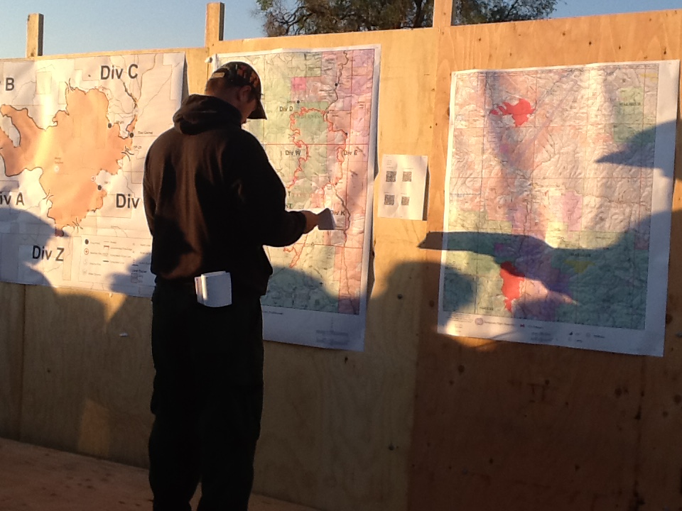
Downloadable file: A firefighter checks information at the Stouts Fire in southwest Oregon
FIRES CURRENTLY BURNING ON ODF-PROTECTED LANDS
The Eldorado Fire located approximately 8 miles southeast of Unity, Oregon is burning on Oregon Department of Forestry private lands, Vale BLM and Wallowa-Whitman National Forest lands. The fire lies on the north and south side of Highway 26 between Unity and Ironside, two small communities south of Baker City in eastern Oregon.
The fire size is now estimated at 20,237 acres and 10 percent contained.
20-person hand crews have started trickling in to support the bulldozers and engines that have been working on the Eldorado Fire the past three days. Yesterday bulldozers continued developing containment lines in moderate terrain.
Because of the many fires burning across Oregon and Washington, the people and equipment available for containing these fires is spread thin. “The weather and the number of large fires burning in the Pacific Northwest have made this fire difficult,” said Incident Commander Link Smith, “however, we’ve put a plan together that we feel will help us meet our objectives, which is to minimize acres burned while keeping safety for the public and firefighters a top priority.”
Overnight crews removed fuel around a few structures and strengthened containment lines along the southern and western portions of the fire. “Normally, on a fire this size over 300 firefighters would be constructing containment lines,” said Marvin Vetter, Operations Section Chief. “However, because of the many wildfires burning throughout the West the Eldorado Fire team is doing all it can with its limited resources.”
Today’s plan includes using hand crews to connect containment lines started by bull dozers on the northwest side of the fire. On the southwest corner of the fire crews anticipate building containment lines to help keep the fire on the east side of Ironside Mountain. Stronger winds are forecasted over the next few days that will challenge established containment lines and increase fire behavior.
Yesterday the wind stoked the fire front on the fire’s west and south sides. Weather reports from the Boise Weather Center predict a dry cold front coming through the area early today with 10-15 mile per hour winds. Fire incident meteorologists are calling for more difficult weather toward the end of the week.
Last night, engine crews worked through the night to extinguish hot spots along the fire’s edge and strengthen containment lines.
Resources: Resources currently assigned to this fire include four 20-person crews, seven bulldozers, 12 engines and one helicopter.
Highway 26 is now open to motorists. The Cause of the fire is under investigation.
ESTIMATED COST TO DATE: $487,000
MORE INFORMATION:
BAKER CITY JOINT INFORMATION CENTER (JIC) (541) 523-2905
http://inciweb.nwcg.gov/incident/4502/
www.facebook.com/ElDoradoFire2015
eldoradofire2015@gmail.com
#EldoradoFire
Ready Set Go: www.wildlandfirersg.org
> The Canyon Creek Complex located one mile south of the towns of John Day and Canyon City, Oregon, was sparked by lightning on August 12, 2015 and is burning on federal, state and private jurisdiction lands. It is currently estimated at 40,100 acres and is 0 percent contained.
It is being managed under a unified command structure with federal and state representation. A Type 1 Great Basin Incident Management Team (IMT), IC Lund, and the Oregon State Fire Marshal Red Team, IC Walker, are currently managing firefighting efforts.
This fire continues to challenge firefighters due to the extremely dry conditions, rugged terrain and afternoon winds. Additional firefighting resources continue to arrive from around the state and country with more than 300 firefighters currently assigned and more are anticipated to arrive to assist.
Yesterday air tankers and helicopters supported hand crews as they worked digging fire line in terrain too rugged for bulldozers. Late in the afternoon air tankers were diverted to a new fire that was burning nearby, however helicopters continued fight the fire.
Structural firefighters worked to protect homes and to determine the number of houses lost to the fire during the extreme wind event that occurred on Aug. 14th. Fire activity increased on the southern portion of the fire, near Dry Soda Lookout. Firefighters worked through the night to protect houses and to reinforce fire line.
Sunday afternoon two community meetings were held at the high school. Community members who have lost homes and property to this fire attended the first meeting and the second meeting provided fire information to the general public. More than 50 people attended the first meeting and more than 220 people attended the second. Speakers included local officials and firefighting personnel.
Today, the fire managers expect weather similar to yesterday, however the possibility of unpredictable winds exists. Firefighters continue working to improve total fire containment and line strengthening in the North. Today we will have a special focus with new resources on the South flank where activity is increasing. Firefighting aircraft will be used aggressively to keep this fire in check, however those resources can be diverted to new fires at a moment’s notice.
Communities under Level 3 and Level 2 evacuations:
Level 3: Dog Creek-south of Marysville
Marysville South
Pine Creek – Gravel Pit, South
Canyon Creek
Edgewood Drive Level 2: Laycock Creek Adams Drive
Nans Rock Rd West Bench Rd
Luce Creek Marysville North
Pine Creek – Gravel Pit, North
Dog Creek-north of Marysville
An American Red Cross shelter has been established at the Mt. Vernon Community Center at 640 Ingle Street. Donations can be brought to the fairgrounds pavilion between 10:00 AM and 5:00 PM.
The Red Cross is transitioning to providing financial and relief services for displaced residents. Those wishing to make monetary donations on behalf of displaced residents can contact the American Red Cross Mountain River Chapter at redcross.org/cascades or in person at the shelter located on Ingle Street in Mt. Vernon. Other donations are being accepted at the pavilion at the fairgrounds in John Day.
Closures
An emergency fire closure is in effect in the Strawberry Mountain Wilderness area. A copy of the closure order and map is available at http://inciweb.nwcg.gov/incident/4495/ Forest Service personnel have assisted with escorting campers and other recreationalists out high-use areas, coordinating with Grant County Sheriff’s Office and other local agencies to facilitate the closure.
Additional information on the Canyon Creek Complex can be found on Inciweb at: http://inciweb.nwcg.gov/incident/4495/.
Please be advised of increased fire traffic and smoky conditions throughout the area. Forest officials ask that the public stay clear of all fire activities. Power lines have been damaged by fire and some residents may be using generators. Without an automatic cutoff switch, generators can pose an extreme hazard to power company employees due to back-feeding, please don’t plug generators into the electrical system without an approved cutoff device.
Firefighting resources remain scarce due to the high number of fires burning regionally, however this fire is a very high priority both within the state and nationally. As other incidents wind down fire crews and equipment become available and if requested by commanders they are assigned to the Canyon Creek Complex. Firefighters will continue to work hard until this situation is brought to an end.
Additional fire information can be found at JDIDC – BICC sites online at: http://bicc-jdidc.org/index.shtml.
For more information on the Malheur National Forest, please visit us at www.fs.usda.gov/malheur, follow U.S. Forest Service- Malheur National Forest on Facebook, and follow @MalheurNF on Twitter for all the latest forest news.
To report a fire, contact the John Day Interagency Dispatch Center at 541-575-1321 or the Burns Interagency Communication Center at 541-573-1000.
Canyon Creek Complex Fire Info
canyoncreekcomplex@gmail.com
Inciweb: http://inciweb.nwcg.gov/incident/4495/
Facebook: Great Basin National Incident Management Team 1
http://bicc-jdidc.org/index.shtml
Phone: 541-575-3040 / 541-575-3480
> Cornet-Windy Ridge Complex
The Cornet-Windy Ridge Complex is comprised of the lightning-caused Windy Ridge Fire (ODF Northeast Oregon District – Baker Sub-Unit) located 4 miles west of Durkee first reported August 11 and the lightning-caused Cornet Fire (ODF Northeast Oregon District – Baker Sub-unit). The fire has been burning on ODF-protected lands, U.S.F.S. and B.L.M. in brush, grass and timber and is now estimated at 96,762 acres and 30 percent containment.
The terrain on the fire is rugged and steep and ground crews have trouble accessing certain areas. This has necessitated aggressive air suppression including single engine air tankers (SEATs), helicopters and heavy air tankers, though increasingly scarce resources are straining air support.Favorable night weather conditions allowed fire fighters to conduct burn out operations that were successful in the north portions of the fire. Crews continue to patrol and hold lines while mopping up around structures. Today’s weather conditions will allow for a favorable day for fire fighting efforts.
Burnout operations today will occur on Woods Gulch Road and Burnt Canyon Road to prevent fire from spreading to the east. Smoke will be visible from I-84.
Resources: A partial list of resources includes 19 crews, 4 helicopters, 34 fire engines and 12 bulldozers, as well as Southwest Incident Management Team-Mark Ruggiero and Oregon State Fire Marshal’s Office-Ted Kunze.
Area Fire Closures:
A forest closure order is in place for the area around the Cornet / Windy Ridge Fire. Please see the link to the Wallowa-Whitman National Forest Website
http://www.fs.usda.gov/main/wallowa-whitman/home OR-245 remains closed. As of this morning, Highways- 7 and Interstate-84 are open
Highway 245 is still closed 11 miles north of Hereford. Drivers are urged to check highway conditions on tripcheck.com
Regulated closures are in effect on State and private lands protected by Oregon Department of Forestry (ODF) in northeast and central Oregon. Please check with your local Oregon Department of Forestry office for public use restrictions on lands protected by ODF. Visit the Blue Mountain Interagency Dispatch webpage at www.bmidc.org or contact a local ODF office for more complete information.
Public shelters: As of 10 a.m. today, the American Red Cross has placed its shelter at the Baker City Nazarene Church, 1250 Hughes Lane, into standby status. Workers remain in place to reopen the shelter if requested by individuals affected by area wildfires or as needed in response to changes in fire activity / evacuation notices. Red cross nurses are available for evacuees that need medical attention. For more information: 541-519-2360.
Public Safety: the public should be cautious when driving; crews and equipment are working near and along the roads, and smoke may hinder visibility.
Cornet-Windy Ridge Complex Fire Info
Joint Info Center: 541-523-2905 (MEDIA requested to use this number)
http://inciweb.nwcg.gov/incident/4478/
> The Eagle Complex (Northeast Oregon District – Baker Sub-Unit) reported Tuesday afternoon burning approximately 16 miles northeast of Baker City and 10 miles east of Medical Springs, Oregon, is now approximately 2,217 acres. The fire is burning on U.S.F.S. lands and lands protected by O.D.F. Three fires comprise the complex and are burning on the Wallowa-Whitman National Forest as well as private lands protected by Oregon Department of Forestry.
Rocky Mountain Team Black assumed command of the Eagle Complex at 6:00 a.m. yesterday morning.Yesterday firefighters continued to protect structures and assess opportunities to construct containment lines.
Most of the fire growth yesterday took place in the southeast section of the fire in the Bradley Creek area. Today, firefighters will continue structure protection efforts. Crews will also improve and hold the west and southwest sides of the fire and continue efforts to prevent the fire from turning north into East Eagle Creek. Aviation resources plan to resume assisting firefighters’ efforts as conditions allow.
Weather today is expected to be warm and dry with increased warming and drying expected later this week.
Public meeting: Representatives from Rocky Mountain Team Black, Oregon Department of Forestry and the U.S. Forest Service will meet with residents of the Eagle community at 3:00 pm today at Baker City Nazarene Church Gymnasium.
Closures: There is an area closure in effect for the Eagle Complex near Main Eagle, East Eagle, Tamarack Campground and Two Color Campground. Please see the link to the Wallowa-Whitman National Forest website http://www.fs.usda.gov/main/wallowa-whitman/home .
Evacuations: There is a Level 2 (Set) for FS 77 Rd. Bennett Peak Area, main Eagle Area, Tamarack Campground.
Rocky Mountain Team Black (Greer), a Type 2 Incident Management Team, assumed command of the Eagle Complex at 6 am today.
Eagle Complex Fire Information
Fire and Evacuation Information: 541-523-2905
Email: BakerCoJointInfo@gmail.com
http://inciweb.nwcg.gov/incident/4481/
> The Stouts Creek Fire (Douglas Forest Protective Association (DFPA) approximately16 miles east of Canyonville near Milo on forestlands protected by DFPA, is currently estimated at approximately 24,756 acres and now estimated at 70 percent containment.
Sunday’s preparation for the burnout operations allowed the night crews to continue what was started late in the afternoon. Overnight crews working on the southwest side of the fire, from DP 69 to Newman’s Gap, were able to make significant progress. Using established fireline, crews were able to use low-intensity burn methods to widen the line as much as 50-75 yards. The day shift will continue these efforts to build and strengthen this line.
With warming temperatures and lowering humidity, fire activity has the potential to increase. Because of these conditions, crews will continue monitoring firelines on the west, north and east sides and address any flare ups that are encountered.
The Stouts Creek Fire has been managed under unified command by Oregon Department of Forestry Team 2 Incident Commander Chris Cline and Forest Service Incident Commander Mike Wilde, since August 13.
Resources: There are 1,144 personnel assigned to the fire with 22 crews, 24 engines, 26 water tenders, 19 bulldozers and 6 helicopters. Numbers of personnel and equipment will continue to shrink as objectives are met and these resources move on to assist with many of the other fires in the state and geographic area.
The Incident Management Team is protecting lands that are about 48% on state protected lands, which include BLM and private lands and 52% on the Umpqua National Forest.
Cost: To date the Stout Creek Fire has cost $29.5 million.
Stouts Fire Information
Phone 541-825-3724
Facebook: www.facebook.com/StoutsFire
#StoutsFire
> The Cable Crossing Fire, (Douglas Forest Protective Association (DFPA) burning on DFPA-protected private and public forestlands six miles east of Glide, is currently estimated at 1,857 acres and 90 percent containment. The cause of this fire remains under investigation.
Cable Creek Fire information:
PH: 541-817-7186
http://inciweb.nwcg.gov/incident/4424/
https://www.facebook.com/DouglasForestProtectiveAssociation
#cablecrossingfire
FIRE PREVENTION
Oregonians are reminded to continue to treat fire season with respect. Everyone is encouraged to follow current fire season restrictions to prevent human caused fires.
Residents who live in the wildland urban interface, where communities border forests and grazing lands, should always be prepared before fire threatens. Have a plan that includes making arrangements for persons with special needs, livestock, and pets. Learn more about the Ready Set Go Program at www.wildlandfirersg.org/.
WILDFIRE SMOKE
Smoke may persist where wildfires are burning in in Oregon, including times when burn-out firefighting operations are taking place. Stay up-to-date on smoke density and public health advisories, orview and monitor Oregon’s air quality index. Wildfires and severe smoke can create dangerous conditions for people, especially those with chronic health conditions. Learn what you can do to reduce the risk of health effects of wildfire smoke.
FIRE STATISTICS*
Fire statistics are for the current year and the average over the past 10 years for the 16 million acres of private and public forestland protected by the Oregon Department of Forestry.
January 1, 2015, through today:*
Lightning-caused fires: 250 fires burned 2710 acres
Human-caused fires: 540 fires burned 27,046 acres
Total: 790 fires burned 29,756 acres
10-year average (January 1 through the present date in the year):
Lightning-caused fires: 228 fires burned 21,511 acres
Human-caused fires: 423 fires burned 3,246 acres
Total: 651 fires burned 24,757 acres
Fire statistics can be accessed any time from the ODF website.*
*When personnel are heavily engaged in firefighting activities, the latest information may not always appear in the statistics.
NEWS MEDIA
News media may call the Fire Information Duty Officer, who is currently Cynthia Orlando, 503-510-7972 (Cell) & 503-945-7421 (office) or any time for fire information. If the duty officer is unable to take your call, you can expect a prompt return call. Media may also call the Oregon Department of Forestry headquarters office, 503-945-7200, weekdays during business hours.
OTHER FIRE INFORMATION
For information on wildfires on all jurisdictions in Oregon, view:
* the Northwest Interagency Coordination Center website, or
* the national Incident Information System site.
ODF Social Media sources for information on fires on Oregon Department of Forestry protected lands:
* the department’s Wildfire blog for news on wildfires statewide and provides current fire statistics
* the ODF’s Southwest Oregon District blog with district-specific wildfire information and Twitter feed
* the Douglas Forest Protective Association Facebook page and Twitter feed
* the Blue Mountain Interagency Wildfire blog for news on wildfires in the Blue Mountains (northeast Oregon)
* the ODF Forest Grove District’s Fire blog with district-specific wildfire information
* the ODF Central Oregon District’s Twitter feed
ABOUT THIS UPDATE
This update provides information primarily about fires on Oregon Department of Forestry-protected lands involving fires 10 acres or larger. ODF provides fire protection primarily on private and state-owned forestland. The department also provides fire protection on some other lands, including U.S. Bureau of Land Management land in western Oregon.
The Oregon Department of Forestry works closely with neighbors and partner agencies to support the firefighting efforts on major fires outside its authority because sharing firefighting resources can help better protect all of Oregon’s forests.
Contact Info:
Cynthia Orlando, 503-510-7972 (cell) 503-945-7421 (office)